| -MAIN
MENU- |
 |
|
|
|
 |
"ABOUT ANCIENT PAMIR" |
 |
 The
facts confirm that, agriculture and home animals appeared
in bronze epoch. But for cultivating of the land people used
stone ploughers. The first worshipping monuments appeared:
four-angled erections with outside entrance-corridor and the
stone altar in the center of the back walls. At the same time
they were intended as tombs or a burial vaults. The dead bodies
were buried inside of the walls, first putting them in the
“stone boxes”. This was the starting time of the worshipping
of the Fire and the Sun. The stone rounded fencing (with the
diameter of 60-46ms) on the starts of the river Big Marjanai
are connected with different ceremonies, dedicated to the
Fire and the Sun. (pic. 3). The
facts confirm that, agriculture and home animals appeared
in bronze epoch. But for cultivating of the land people used
stone ploughers. The first worshipping monuments appeared:
four-angled erections with outside entrance-corridor and the
stone altar in the center of the back walls. At the same time
they were intended as tombs or a burial vaults. The dead bodies
were buried inside of the walls, first putting them in the
“stone boxes”. This was the starting time of the worshipping
of the Fire and the Sun. The stone rounded fencing (with the
diameter of 60-46ms) on the starts of the river Big Marjanai
are connected with different ceremonies, dedicated to the
Fire and the Sun. (pic. 3).
A human being living here in this time anthropologically belonged
to the Mediterranean race type. They came to Pamir from the
south or south-western areas of Southern-Tajikistan or Afghanistan.
To the next thousand years, exploring and population of Pamir
continues, getting tempos and this time is called “Sac”s Period”.
The “Roof of the World”successfully started to be used as
a pasture from the early spring up to late autumn. More than
50 tombs found there tell us about. At the same time in the
neighboring north-eastern areas Sac nomadic TRIBES also pastures
their cattle's.
Excavation of tombs gave us big materials about weapons, house
tools, ceremonial items and a wide trade contacts with Fergana
valley, Xinzyang, India and Afghanistan.
Practical knowledge of ancient peasants was based on solar
calendar, which had original construction. In the valley of
the river Shorolyu (left tributary of the river Kuhdara) in
the area of the Kokjar pass, on the height of the 3850 ms
there were found interesting sloppy figures, made on the earth
from stone (length 6-13 ms) in two colors (black stone and
white quartz). One figure is oriented to spring (autumn) day/night
equality (march 21 and September 23) and two others were oriented
to summer (winter) day/night equality (June 22 and December
22)
The end of I- thousand years, BC. is the famous that, there
was opened the Great Silk Road in II cc. B. C. from China
to the COUNTRIES of CENTRAL and Front Asia. In the area of
Dunkhuan district the road divided into two, - the northern
road went to Ferghana valley, the southern after crossing
Saricol range went to south. The southern road is famous under
the name of Vakhan or Great Buddhian Road and Shugnan. This
was the road of trade caravans, buddhian worshippers and missioners.
To this time the Western Pamir enough explored, that there
were built huge defensive castles ( Kah-Kaha in Namadgut village),
fortresses settlements. Most of them were built in I cc. B.
C. – Icc. B. C. ( Kushan period)The lack of plain lands and
the defense purposes insisted them to build settlements on
a high rocky mounds. Magnificent erections (the height of
the walls preserved up to 3-meters) are seen in the background
of snow cowered peaks. It is the unrepeatable museum under
the open sky, which created by the ancestors of modern people,
who live now in Vakhan, Shugnan, Rushan, Yazgulem and Vanch.
Mostly, special type of agriculture – agricultural farms were
developed. According to modern measures, in ancient times,
however up to XII cc. there no villages at all. The big Patriarchic
families (with up to 60 people) lived in the village farms.
The strong walls with towers, defended living and farmhouses.
In the early middle ages (VI-VII cc.) fire worshipping well
confirmed, that there appeared fire temples (In village farms
there were special rooms for holy fire)and in ancient manuscripts
local people were called fire worshippers. The name of “ Great
Budding Road”was confirmed in ancient Vakhan. 4-stored Buddha
temple in the village of Vrang. The sitting niches for worshippers
were cut around the terraces, and some of them were remained
under the foothills of the temple.
In the place of ancient ford through the river Pyan j (between
Ishkashim and Rin village) there was built a pier-caravanserai
Dorkisht. Walls with towers defended caravanserai and descent
to the river.
The exploring of natural resources started in the period of
IX-XI cc. In XII cc. a rich spinal mines were found in the
area of the village Kuhi-lal, in ancient times famous as Badakhshan
lal stones. The reason that they are called Badakhshan stones
the well-known ancient mineralogist Biruni (XI c) explaines,
that, they were taken to Badakhshan, where they were granned,
polished and sold. The mine belonged to the governor of Vakhan,
who kept a control over the producing and exporting of the
precious stone.
Silver mines containing silver ores were also important ones.
They started to mine it in Shugnan, in the uppers of Gunt
and it's right tributary Tokuzbulak river in Bachor range.
There were found some settlements of miners and metallurgists.
But the mines in the Eastern Pamir were famous. In XI cc.,
the most sources of silver (ancient Ilak in the Republic of
Uzbekistan and in Shelji in the territory of modern Kirghistan)which
were exported finished, there was so called “Silver crisis”.
In this moment, the above mentioned silver mines in Shugnan
were of big importance for the further exploring of silver
resources in the “Roof of the World”
In the northern slopes of the North-Alichur range in the valley
of the river Ak-jilga on the hight 3980 ms above the sea level
there was built a small town. It consisted of caravanserai,
administrative center, town buildings with living houses,
fire temple, cemetery (more than 500 tombs) and the bathroom
with underground heating.
The most highest mountain mine among the well-known resources
was situated in the uppers of the river Sassik on the high
of the 5000 ms above sea level.
You can do TRAVELs according to several routes. But before
making TRIPs along the ancient caravan roads, don't forget
to visit Regional Ethnographic museum and the local Botanical
Garden.
Vakhan itinerary : Khorog-Ishkashim – 104 kms.
It is worth of seeing here the village of Anderob, from where
the road turns to Garmchashma (7 kms) – medical thermal spring.
In the background of severe rocks it is possible to see the
white cupolas of calcite mineral mounds. There are many medical
thermal and mineral water springs like narzan and borjomi.
8 kms further, there is a Kuhi-lal village, where one can
see ancient mines of high quality spinel. (pic. 7)
District centre Ishkashim and the village Rin. Some fortresses
settlements and defense castles, pier-caravanserai on the
bank of the river Pyan j.
After Ishkashim:
The Kah-kah-ha castle (IV cc. B. C) – the walls of it strengthened
with 55 towers, in the inside of it there are a bastion and
the buildings of local governor (17kms from Ishkashim).
Yamchun village (situated 72 kms from Ishkashim). Upper the
village there is a very early castle. (III cc. B. C.). On
the upper square there is a citadel for garrison. The double
lines of the castle walls are strengthened with 39 towers.
Yamg village. (80 kms from Ishkashim). In the territory of
the village the old system of the solar calendar, which rules
the season dates of the Sunset was preserved. There is the
tomb of the sufi-astronomer Muborak (died in 1885y), who worked
with the calendar.
Vrang village (87 kms from Ishkoshim). The Budding temple
in the upper of the village on the rocky slope. A sitting
niches around the temple for buddhian worshippers.
Zong village (113 kms from Ishkoshim). Around the village
on the rocky slopes there are ruins of some castles, among
them the Vishimkala ( Anreshimkala) is the biggest. In the
inside living and warehouse buildings compactly were built.
A guarding tower built looking to the gorge. Ancient times
there was situated the fire temple, built cross-like and there
was a stowed for the holy fire.
District of the villages Zong-Hissor-Langar, traditionally
called as the “Meeting of the main roads”. It is the point,
where Pamir river joins with Vakhan-Darya and the Pyanj river
starts. There is the road to Eastern Pamir and Afgan Vakhan.
The Castle of Ratm ( Kushan period), in front of which a guarding
tower with a high of more than 3 meters was staying, took
a control over the region. The remains of the castle are situated
after the village of Langar, on the bank of the river Pamir,
which runs here in the deepest gorge. In the area of Langar
there are majority of pethroglifs were found. |
|
|
|
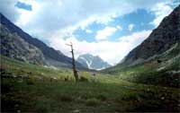
-GREAT PAMIR- |
|
|
|
|
|